Greenland’s Arctic coastal climate
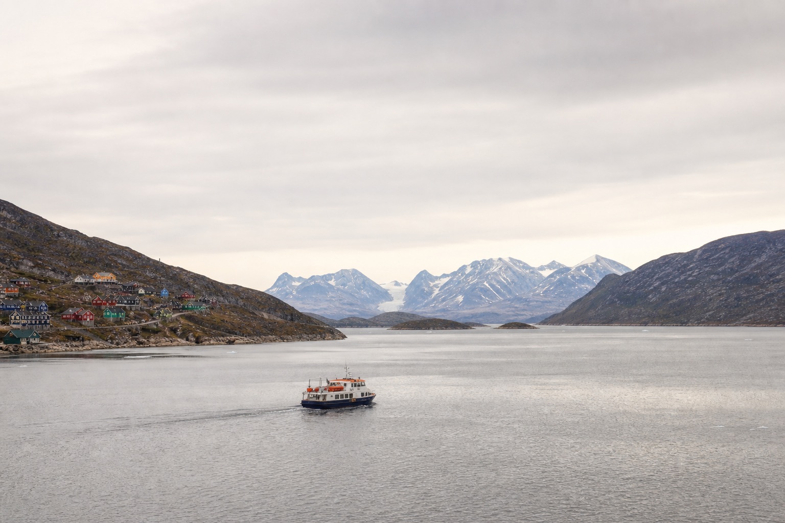
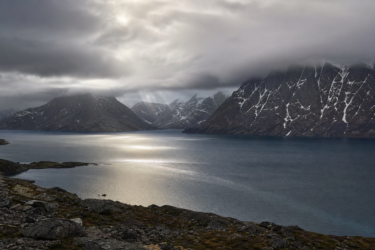
Greenland has an Arctic climate, with long, dark winters and brief, milder summers. That does not mean conditions are the same across the country. Most towns and settlements are on the ice-free coastal strip, while the interior is covered by the ice sheet. Travel therefore takes place mainly along the coast, where the sea, mountains, wind and local cloud cover all affect the weather.
Distances are large, and conditions can differ between regions. Weather in one town is not necessarily a useful indication of what is happening at the next destination. This matters when planning a trip with several stops, particularly because travel between Greenlandic destinations usually involves flights rather than roads.
We recommend treating the weather as part of the itinerary, not simply as a guide to what to pack. Cloud cover, wind and sea ice can affect flights, boat travel and outdoor activities. That applies both to travel days and to days set aside for the main purpose of the trip.
Monthly temperatures, town by town
Greenland spans more than 24 degrees of latitude, and the climate varies clearly from one town to the next. The figures below come from DMI's official "Climatological Standard Normals 1991–2020 – Greenland" (DMI Report 21-12) — the 1991–2020 reference period, unless a table states otherwise. Most travel sites leave out which period their figures cover; we state it because the reference period is part of what makes a number more than a guess.
Each table gives three lines: mean maximum (closest to a typical daytime high), the overall mean temperature (the average of all readings around the clock), and mean minimum (closest to a typical overnight low).
Ilulissat (DMI station 4221, the airport, 69°14′N)
| Jan | Feb | Mar | Apr | May | Jun | Jul | Aug | Sep | Oct | Nov | Dec | Annual | |
|---|---|---|---|---|---|---|---|---|---|---|---|---|---|
| Mean max (°C) | -9.2 | -11.3 | -10.9 | -4.0 | 3.1 | 9.0 | 11.5 | 9.6 | 5.3 | -0.3 | -4.0 | -6.3 | -0.6 |
| Mean (°C) | -12.6 | -14.8 | -14.5 | -7.3 | 0.3 | 5.8 | 8.3 | 6.6 | 2.6 | -2.9 | -7.0 | -9.4 | -3.7 |
| Mean min (°C) | -16.2 | -18.6 | -18.8 | -11.6 | -2.9 | 2.7 | 4.9 | 3.1 | -0.5 | -6.0 | -10.3 | -12.7 | -7.2 |
Sisimiut (DMI station 4234, the airport, 66°57′N)
| Jan | Feb | Mar | Apr | May | Jun | Jul | Aug | Sep | Oct | Nov | Dec | Annual | |
|---|---|---|---|---|---|---|---|---|---|---|---|---|---|
| Mean max (°C) | -8.4 | -10.3 | -8.4 | -2.0 | 4.0 | 9.0 | 11.6 | 10.7 | 6.8 | 2.0 | -2.3 | -5.2 | 0.6 |
| Mean (°C) | -11.5 | -13.7 | -12.0 | -5.5 | 0.7 | 5.1 | 7.6 | 7.3 | 4.1 | -0.7 | -5.0 | -8.0 | -2.6 |
| Mean min (°C) | -14.5 | -17.0 | -15.5 | -8.9 | -2.2 | 1.9 | 4.3 | 4.5 | 1.5 | -3.2 | -7.6 | -10.7 | -5.6 |
Nuuk (DMI station 4250, 64°11′N)
| Jan | Feb | Mar | Apr | May | Jun | Jul | Aug | Sep | Oct | Nov | Dec | Annual | |
|---|---|---|---|---|---|---|---|---|---|---|---|---|---|
| Mean max (°C) | -5.3 | -5.8 | -5.5 | -1.0 | 3.7 | 8.0 | 10.5 | 9.7 | 6.3 | 2.0 | -1.3 | -3.1 | 1.5 |
| Mean (°C) | -7.7 | -8.3 | -7.8 | -3.2 | 1.1 | 4.7 | 7.0 | 6.7 | 3.9 | 0.1 | -3.3 | -5.3 | -1.0 |
| Mean min (°C) | -9.8 | -10.5 | -10.0 | -5.3 | -1.1 | 2.0 | 4.2 | 4.4 | 2.1 | -1.6 | -5.1 | -7.3 | -3.2 |
DMI's own 1991–2020 annual mean for Nuuk is -1.0°C. Some travel sites quote roughly +1°C — that figure does not match DMI's table, and we take DMI's own calculation as authoritative.
Qaqortoq (DMI station 4272, 60°43′N)
| Jan | Feb | Mar | Apr | May | Jun | Jul | Aug | Sep | Oct | Nov | Dec | Annual | |
|---|---|---|---|---|---|---|---|---|---|---|---|---|---|
| Mean max (°C) | -1.9 | -2.5 | -1.1 | 3.4 | 6.7 | 9.8 | 11.7 | 11.2 | 8.7 | 4.8 | 0.9 | -1.0 | 4.2 |
| Mean (°C) | -4.9 | -5.5 | -4.1 | 0.4 | 3.4 | 6.2 | 8.1 | 8.1 | 5.9 | 2.3 | -1.7 | -3.7 | 1.2 |
| Mean min (°C) | -7.8 | -8.6 | -7.4 | -2.7 | 0.2 | 2.7 | 4.6 | 5.3 | 3.5 | -0.1 | -4.0 | -6.4 | -1.7 |
Qaqortoq is the warmest of the five towns, consistent with its southern position at 60.7°N — roughly the same latitude as Oslo.
Tasiilaq (DMI station 4360, Ammassalik, 65°36′N)
| Jan | Feb | Mar | Apr | May | Jun | Jul | Aug | Sep | Oct | Nov | Dec | Annual | |
|---|---|---|---|---|---|---|---|---|---|---|---|---|---|
| Mean max (°C) | -3.3 | -3.1 | -2.6 | 1.3 | 4.5 | 8.4 | 10.9 | 10.3 | 6.9 | 2.5 | -0.4 | -2.3 | 2.8 |
| Mean (°C) | -6.0 | -6.1 | -5.9 | -2.2 | 1.3 | 4.8 | 7.2 | 6.9 | 4.2 | 0.1 | -2.8 | -4.9 | -0.3 |
| Mean min (°C) | -8.9 | -9.2 | -9.2 | -5.7 | -1.8 | 1.3 | 3.5 | 3.8 | 1.7 | -2.2 | -5.2 | -7.6 | -3.3 |
Tasiilaq is milder in winter than its latitude alone would suggest — comparable to Sisimiut, which sits further north on the west coast. Summers, however, are cooler and foggier; we cover that below.
Source for all five tables: DMI Report 21-12, Table 3 (mean), Table 5 (mean maximum) and Table 9 (mean minimum). Reference period 1991–2020.
Precipitation
DMI's headline finding is unambiguous: precipitation is far higher in South and Southeast Greenland than in the north and along the central west coast, and it decreases from the coast inland along the fjords. Ilulissat and Sisimiut, the two towns most visitors see, are genuinely dry places — closer to desert conditions than "coastal Greenland" otherwise suggests.
| Jan | Feb | Mar | Apr | May | Jun | Jul | Aug | Sep | Oct | Nov | Dec | Annual | |
|---|---|---|---|---|---|---|---|---|---|---|---|---|---|
| Nuuk (normal) | 72.8 | 55.4 | 59.2 | 53.0 | 60.5 | 61.7 | 75.5 | 92.7 | 106.0 | 79.7 | 82.6 | 74.9 | 874.0 |
| Qaqortoq (normal) | 75.6 | 77.7 | 63.8 | 66.7 | 58.3 | 69.3 | 81.6 | 103.0 | 116.2 | 88.8 | 100.6 | 70.1 | 971.7 |
| Tasiilaq (normal) | 113.2 | 99.3 | 93.6 | 75.4 | 58.3 | 34.9 | 39.4 | 58.8 | 89.8 | 71.0 | 91.4 | 90.0 | 915.1 |
| Sisimiut (average, 2002–2020) | 48.8 | 29.9 | 31.5 | 32.0 | 30.3 | 25.1 | 51.6 | 62.4 | 60.5 | 62.4 | 62.4 | 55.7 | 552.6 |
All figures in mm. Nuuk, Qaqortoq and Tasiilaq are DMI's 1991–2020 normals. Sisimiut's own gauge record is too short for a full 30-year normal, so its figure is DMI's average for 2002–2020 — labelled separately because it is not calculated on the same basis as the other three.
Note Tasiilaq's unusual shape: driest in the middle of summer (June–July), wettest in autumn and winter — the opposite of the impression that summer is the rainy season.
Ilulissat has no published precipitation normal of its own — the town's gauge is absent from DMI's precipitation tables, unlike the temperature tables above. The nearest verified figure is Aasiaat, roughly 70 km south of Ilulissat on the same stretch of coast, with a DMI 1991–2020 normal of 330.6 mm/year. That is a regional proxy, not a measurement of Ilulissat itself, and should be read as one.
The highest 24-hour rainfall recorded 1991–2020 was 118.0 mm at Qaqortoq, 7–8 October 2012. The highest 24-hour rainfall ever recorded anywhere in Greenland was 183.5 mm at Ikerasassuaq in Southeast Greenland, 1–2 November 1964 (DMI Report 21-12).
Daylight: midnight sun and polar night
The dates below come from timeanddate.com's sun calculator for 2026 and can shift by about ±1 day from year to year, depending on how a given tool defines "sunrise". Treat them as accurate to within a day, not to the minute.
| Location | Latitude | Midnight sun | Polar night | Note |
|---|---|---|---|---|
| Ilulissat | 69°14′N | 20 May – 23 Jul (≈65 days) | 30 Nov – 11 Jan (≈43 days) | — |
| Sisimiut | 66°55′N | 3 Jun – 9 Jul (≈37 days) | None | The sun clears the horizon briefly every winter day; shortest day ≈1h37m (around 21 Dec) |
| Nuuk | 64°11′N | None (south of the Arctic Circle) | None | Longest day (21 Jun) ≈21h10m; shortest day (21 Dec) ≈4h06m |
| Qaqortoq | 60°43′N | None | None | Longest day (21 Jun) ≈19h09m; shortest day (21 Dec) ≈5h38m |
| Tasiilaq | 65°36′N | No true midnight sun | No true polar night | See below |
Tasiilaq is worth knowing about on its own terms: the town sits so close to the midnight-sun line that on the 21 June solstice the sun sets at 01:08 and rises again at 01:56 — under an hour below the horizon, with about 23h12m of daylight that day. DMI's own report states it plainly: the midnight-sun line passes through Tasiilaq. The town has no true polar night either; DMI puts the polar-night boundary roughly 200 km north of Tasiilaq. It is a detail rarely mentioned, but it is verifiable and tells you something concrete about where Tasiilaq actually sits.
The piteraq, foehn winds and summer fog
Beyond the ordinary seasonal swings, Greenlandic weather has a handful of named phenomena worth knowing if you are travelling to particular regions.
The piteraq is a violent, cold, katabatic (downslope) wind off Greenland's east coast, most exposed in the wide bay south of Tasiilaq and at the Kangerlussuaq fjord on the east coast (a separate, unpopulated fjord, not the west-coast airport town of the same name). It forms when cold air of Canadian origin is forced down off the ice sheet by a low-pressure system moving along the coast — wind speed can rise from calm to gale force within minutes. DMI's report documents one extreme case: the piteraq that struck Tasiilaq in February 1970, when the temperature was about -20°C and peak wind speed came close to 90 m/s (roughly 324 km/h).
Foehn winds can produce the opposite effect on the west coast: warm, dry air that raises temperatures sharply in winter. DMI documents a specific case at Qaqortoq, 26 November–6 December 1997, when the temperature rose from -21.9°C to +8.6°C within 24 hours — a 30.5°C swing — while relative humidity fell from about 80% to 40%. The event lasted nine days in total and was felt as far north as Sisimiut. Nuuk has its own named southerly gale, the "sydvesten" (Greenlandic: nigersuaq), which can reach gale force and occasionally pushes winter temperatures up to 10–15°C for a short period.
Summer fog affects the west coast in particular. DMI puts the fog season at May to September, peaking in July, when coastal waters are foggy roughly 20% of the time. The fog forms because open summer water stays cold, chilled by melting ice, under warmer air above it. It typically sits on the outer coast and dissolves quickly once the daily sea breeze carries it into the fjords — part of the reason the airports at Kangerlussuaq and Narsarsuaq, both well up their fjords, were sited where they were.
Sea ice
Sea ice follows an annual pattern that DMI describes from median ice-chart data for 2000–2020 — a typical course of events, which DMI itself states varies from year to year, not a fixed calendar.
Ice is close to its greatest extent February–May, when in some years it can reach as far south as Cape Farewell on both coasts. From June it retreats, reaching its minimum extent August–September, when the west coast is essentially clear while the east coast typically pulls back to around 75°N — with a variation of several degrees of latitude from year to year. Regrowth begins in October.
On the west coast around Disko Bay (Ilulissat), DMI's rule of thumb is that ships can typically sail to and from Aasiaat and Ilulissat from mid-May to mid-December — a DMI rule of thumb, not a fixed date, and it varies with how much "west ice" the Labrador Current carries south. Note that this is sea ice, a separate phenomenon from Ilulissat's iceberg season: icebergs calved from the Sermeq Kujalleq (Jakobshavn) glacier into the Icefjord sit in the bay year-round — DMI describes Disko Bay as one of Greenland's most productive iceberg areas.
On the east coast, the East Greenland Current carries "storis" (drift ice/pack ice) along the coast for most of the year, and at the coldest point of winter it can block the coast right down to and around Cape Farewell.
How conditions change with the seasons
Greenland’s seasons are distinct. Winter is long, dark and cold, while summer is shorter, lighter and milder. The right season depends on which activities matter most to you, but travelling during the normal season for an activity does not guarantee suitable conditions on a particular day.
Dog sledding runs from January to April. It is legally restricted to West Greenland north of the Arctic Circle and to East Greenland, an area defined by what is known as the dog line. Dog sledding does not take place in Nuuk, Qaqortoq or anywhere in South Greenland. This geographical restriction is as important as the season when choosing a destination.
Northern lights are visible from September to April. Humpback whales are present in Disko Bay from mid-June to August, while hiking and kayaking generally run from June to September. These periods are useful for choosing travel dates, but wind, cloud cover and local conditions still determine what can happen on the day.
A season should therefore be understood as the period in which an activity is normally possible, not as a promise that every departure will operate. This distinction applies in the middle of a season as well as during the transition between seasons.
Winter weather and travel
Cold and wind are the most noticeable parts of winter weather. Wind often makes being outside feel considerably colder than the temperature alone suggests. Visibility and cloud cover can also change over the course of a day.
A winter itinerary should not depend on one evening or a single fixed activity day. If conditions are unsuitable, an excursion may need to move, change in length or be replaced. With only one day at a destination, there may be no practical opportunity to try again.
This is particularly relevant for northern lights trips. The northern lights season extends from September to April, but cloud cover can prevent a sighting even when the lights are present. Booking a trip during that period gives you the correct seasonal basis; it does not remove the effect of the weather. Several nights at a destination provide more opportunities than one, although they still do not guarantee clear conditions.
Darkness is part of winter, but it should not be converted into a precise expectation about daylight without considering the destination and travel date. Conditions change through the season and vary according to where you are in Greenland. We plan around the local possibilities at a particular destination rather than a single general idea of Greenlandic winter.
Winter clothing should also match the booked activity and the length of time spent outdoors. A short trip close to town and a longer excursion in open terrain do not necessarily require the same equipment. Layers, wind protection and a way to keep hands and feet dry are more useful planning principles than packing for one stated temperature.
Summer is milder, not weatherproof
Summer provides the usual conditions for many trips on foot and on the water. Hiking and kayaking run from June to September, and humpback whales are present in Disko Bay from mid-June to August. Roughly 15 whale species occur in Greenlandic waters overall, but the specific Disko Bay season for humpbacks is the useful date range when planning that activity.
Summer days are not uniform. Wind and cloud can change how an activity is carried out, and trips on the water may be adjusted when conditions are unsuitable. A booking in the middle of the normal season can still be moved or cancelled.
It is therefore sensible to avoid an itinerary in which an important outdoor activity has only one possible time slot. An additional day does not guarantee that an excursion will operate, but it gives more room to rearrange the plan than an itinerary with no spare time.
Summer packing should allow for time in town, boat travel and activities in open terrain on the same trip. Layers, a wind- and water-resistant outer layer, and practical footwear are generally more useful than clothing suited only to calm conditions. Wind on a boat feels different from wind during a sheltered walk, so the activity matters as much as the season.
Flights, connections and cloud cover
Flights are central to travel between Greenlandic destinations. Wind and cloud cover can affect operations, and delays or changes can disrupt onward connections. Short transfer times and separate bookings are particularly exposed, especially when the next part of the journey operates only on a particular day.
We advise against placing an essential activity immediately after a flight arrives. A timetable may appear to leave enough time, but it offers little room if the flight changes. The same principle applies before departure: an activity scheduled just before an important flight leaves few alternatives if the excursion has to move.
A more robust itinerary leaves time between parts of the journey that cannot easily be replaced. This may be between a domestic flight and an international departure, or between arrival in a town and the trip’s main excursion. A buffer day is not necessarily unused time. It can be spent in town or used for an activity that is less dependent on a particular set of conditions.
It is also worth considering the effect of a delay separately from a cancellation. Either can change the order of a trip, but even a relatively small shift can cause problems when the schedule is tight. The more destinations included within a short period, the more flights and connections have to operate as planned.
Weather planning does not mean assuming that flights will be disrupted. It means recognising what happens to the rest of the itinerary if one sector changes. We look for routes that can absorb an adjustment without losing the main reason for travelling.
Wind, sea ice and activities on the water
The sea is both a transport route and the setting for many excursions. Wind and sea ice can affect boat travel and other activities on the water. Conditions are assessed locally, and the decision on the day determines whether a trip can operate as planned.
A stated departure time and duration should be treated as the plan under suitable conditions. A boat trip may be moved, adapted or cancelled if required. The same applies to kayaking, where wind directly affects whether the activity can take place.
The price of a boat tour varies between destinations and tour types; our article about prices in Greenland covers the observed price levels with source and date. If a departure has to move because of the weather, ask about the available local options rather than assuming that any booking can be transferred to any other time.
Sea ice should not be treated as one uniform winter condition across Greenland. Its practical effect varies by place and time. If a route or activity depends on open water or particular ice conditions, it needs to be planned using current local information rather than the season alone.
This is also why a water-based activity should not be placed into the only free period between two flights. If wind or ice changes the departure, the rest of a tightly arranged itinerary may leave no workable alternative.
Do not plan around a single attempt
The main weakness in many itineraries is not the chosen season but the absence of alternatives. If the entire purpose of a trip depends on one boat departure, one northern lights evening or one dog-sledding excursion, the weather has a disproportionate effect on the outcome.
We prefer to leave enough time for a weather-dependent activity to move or be exchanged for something else. Activities also need to match both the season and the geography. Dog sledding, for example, is available from January to April, but only in West Greenland north of the Arctic Circle and in East Greenland. Choosing January does not make it available in Nuuk, Qaqortoq or South Greenland.
Likewise, travelling to Disko Bay between mid-June and August places a visit within the period when humpback whales are present, but wind can still affect a whale-watching departure. Travelling from June to September fits the hiking and kayaking season, while the day’s conditions still determine whether a particular route or water activity is suitable. Northern lights travel from September to April remains dependent on cloud cover.
If outdoor activities are a priority, fewer destinations with more time in each place are usually easier to adjust than several short stays. Every additional flight or connection creates another point at which wind or cloud cover can affect the plan.
When comparing itineraries, we suggest looking beyond the number of included activities. Check how many depend on the weather, whether several are scheduled on the same day, and whether there is another opportunity later in the stay. That provides a better indication of how the itinerary will handle a change than a long list of excursions.
Packing for variable conditions
Packing should be based on the activity rather than on a single general description of the season. Greenland has an Arctic climate, but a day in town, an exposed hike, a boat trip and a dog-sledding excursion involve different levels of wind exposure and time outdoors.
Layers make it easier to adjust during the day. A wind-resistant outer layer is relevant in both winter and summer, while water resistance is useful for boat trips and other activities near the sea. Hands and feet need to remain dry during longer winter activities, and footwear should suit the terrain and the amount of time spent outside.
We do not recommend packing according to an unverified temperature estimate or assuming that one forecast represents every destination on a multi-stop trip. Coastal conditions can vary, and local wind and cloud cover may matter more to an activity than a general seasonal description.
Equipment supplied for a booked activity and personal clothing serve different purposes. Travellers should check what is included for the specific excursion and prepare for the time before and after it as well. The practical question is not only how cold or mild the season is, but how long you will be outside, whether you will be moving, and how exposed the location is to wind.
How we plan around Greenland’s weather
We begin with the assumption that weather can change any part of an itinerary, regardless of season. Transport comes first. A route with several flights and close connections needs more flexibility than a longer stay in one destination. If an important activity is available on only one day within the itinerary, there should be time for a change where possible.
We then ask whether the trip still makes sense if weather removes one activity. This is a simple but useful test. If the answer is no, the itinerary is either too tight or too dependent on a single type of excursion.
Planning for Greenland’s climate does not mean avoiding fixed arrangements. Flights, accommodation and activities still need to be booked. The itinerary should, however, allow for a change in sequence and recognise that an outdoor activity may not operate at the first scheduled time.
The calendar tells us when dog sledding, northern lights, humpback whales, hiking and kayaking are seasonally relevant. The weather determines what is practical on a particular day. A workable Greenland itinerary needs to account for both.
Last reviewed July 31, 2026